Knauss legislative fellowships in Congress help build careers — and they're fun and educational. See our video and fact sheet for details.
Coastal Flooding and Climate Change
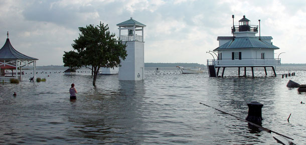
Throughout Maryland's history, flooding and land erosion have caused damage to property and loss of life. As earth’s climate changes and sea levels rise, properties and shorelines may become more vulnerable to flooding and erosion. Maryland Sea Grant works with coastal communities to help them prepare.
Studies show that sea levels are already rising around Maryland for many reasons. Some of those reasons are global in reach, like increasing ocean temperatures and melting glaciers and polar ice caps. Land in the Chesapeake Bay region is also sinking, enhancing the effect of the rising water.
As sea level rises, coastal flooding during storms is expected to worsen. Homes and buildings near the water face more damage than in the past. The effects of Hurricane Isabel in 2003 on the Chesapeake Bay and Hurricane Sandy in 2012 on coastal New York and New Jersey are sobering examples of the future risks our communities may face.
Living Shorelines
Living shorelines use natural materials, such as native plants, sand, and rocks, to protect shorelines from erosion. Like natural marshes, they maintain the connection between land and water, while helping to absorb the energy of waves and tides.
Living shorelines have been used in Maryland since the 1970s. Some of the earliest versions were developed on Maryland's Eastern Shore by chemist and environmental nonprofit founder Edgar Garbisch, who demonstrated how stone, sand, and marsh grasses could help restore deteriorating wetlands. In 2008, Maryland passed the Living Shoreline Protection Act. The act requires that property owners use living shorelines for erosion control, except in cases where they can demonstrate it would not be feasible, such as in areas with excessive erosion, heavy tides, and narrow waterways.
Learn more in the June 2025 issue of Chesapeake Quarterly magazine, Restoration Takes Root: Living Shorelines for Changing Coasts.
Segmented Sills and Shorelines
In living shorelines, sills are low-lying breakwater structures made of rocks or other durable materials. They are designed to reduce wind-wave energy and erosion at the shoreline. Recently, designs have incorporated narrow gaps, called segmented sills. Research shows that these gaps can contribute to marsh growth or erosion.
This video describes the role of segmented sills in living shoreline design:
This video was illustrated by Talia Mastalski, science illustration intern with Maryland Sea Grant, and narrated by Erika Koontz, graduate research assistant at UMCES' Horn Point Laboratory.
This illustration depicts the impacts of accretion and erosion in a Chesapeake Bay tidal marsh:
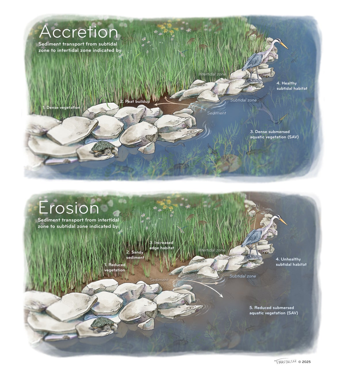
Illustration by Talia Mastalski, based on research by Erika Koontz.
Learn More About Sea Level Rise and the Chesapeake Bay
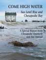
Special Report: Published in October 2014, Come High Water: Sea Level Rise and Chesapeake Bay offers a comprehensive look at the causes and consequences of increasing flooding along Maryland’s coasts. This package, produced by Maryland Sea Grant's magazine Chesapeake Quarterly in partnership with Bay Journal, examines the scientific understanding and projections of the rate of sea level rise in the Chesapeake region; effects on people and the environment; and adaptations and policy responses that are underway or under consideration. An interactive webpage offers videos, photos, and a map showing where flooding is predicted to occur.
Magazine: Ready for Rising Waters? Another issue of Chesapeake Quarterly from December 2010 examines severe storms and their possible effects on coastal flooding in Maryland.
Visualization: See a visualization by Maryland Sea Grant of what the Inner Harbor of Baltimore and other Maryland landscapes might look like if the water rose by the amount predicted in some analyses.
Video: Explore what scientists have discovered about why sea level in Maryland's coastal waters has risen at a rate more than three times that of the global average. Read the accompanying news article for more details.
Program Announcements
News and Blogs


Featured Fellow
Nina Santos
Nina Santos is a Ph.D. student at the Chesapeake Biological Laboratory at the University of Maryland Center for Environmental Science. For her dissertation, she is focused on small shrimp-like crustaceans called mysids – an understudied yet important part of many estuarine and coastal food webs.
Featured Research Project
Developing a habitat model for mysids, an important link in Chesapeake Bay food webs
Mysids are important mesozooplankton prey for many species of fish in Chesapeake Bay and are an important link in transferring energy from lower to upper trophic levels. Mysids also serve as biological vectors for benthic-pelagic coupling due to their diel vertical migration and omnivorous prey-switching behavior, which makes mysids important regulators of food web architecture. Despite their central role in coastal food webs, surprisingly little is known about mysid ecology and dynamics in Chesapeake Bay.
