Knauss legislative fellowships in Congress help build careers — and they're fun and educational. See our video and fact sheet for details.
Helping Local Planners Improve the Quality of Coastal Bays
Accessible Computer Model Links Land Use to Water Quality
More people have moved to the Delmarva Peninsula in recent years, drawn by the charms of living near the coast. But that growth has also stressed the ecology of fragile, shallow coastal bays that border the Atlantic Ocean.
These stresses, in places like Sinepuxent and Chincoteague Bays, parallel on a smaller scale those plaguing the much-larger Chesapeake Bay estuary nearby. In both cases, an influx of nitrogen from sources like road and farm runoff has worsened water quality, fostering the development of harmful algal blooms and low-oxygen conditions that stress fish populations.
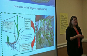 |
| Ecologist Lora Harris presents results from a computer model that links nitrogen amounts to ecological conditions in coastal bays, like seagrass abundance. Credit: Jeffrey Brainard |
Scientists have developed robust computer models describing these impacts across the vast Chesapeake Bay watershed. But nothing like this has existed for the coastal bays in a form that could easily be used by local land-use planners to inform their decisions.
Now, a team of researchers funded by the Sea Grant programs of Maryland, Delaware, and Virginia has filled this need in a novel project in which they teamed up with local officials. The effort produced a new approach designed to help local planners to reduce these negative environmental effects in the coastal bays.
The scientists created a spreadsheet and instructions that are based on the computer models but are simpler to use. Planners can enter data in the spreadsheet about land uses in the watershed of any Delmarva coastal bay — details like crop types, crop fertilization rates, and the number of residents using septic systems. The spreadsheet then estimates the resulting quantity of nitrogen flowing into the bay.
 |
| Sea Grant-funded scientists meet with municipal and county officials to help develop easy-to-use methods for estimating nitrogen amounts. Credit: Janet Krenn |
This allows the planners to run scenarios in which they vary data representing particular land uses and see the resulting changes in nitrogen quantities. The approach can inform local governments as they develop land-use rules and comply with future water-quality regulations.
To create the spreadsheet, the Sea Grant-funded scientists took the unusual approach of consulting with the non-scientist local officials who would be using it.
The scientists held two workshops with municipal and county officials to introduce the computer models and gather feedback about using the data for land-use planning. One resulting change was as simple as translating scientific terms like kilograms and hectares into commonly used measures like pounds and acres.
“We’re really excited about getting the tool into the hands of stakeholders to help them use it to help the coastal lagoons,” said project co-leader Lora Harris of the Chesapeake Biological Laboratory, part of the University of Maryland Center for Environmental Science.
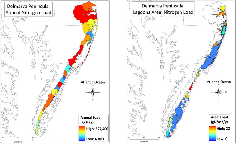 |
| The map at left shows total nitrogen loads on land in areas of the Delmarva Peninsula that drain into the coastal bays. The map at right represents “areal” loads, or the total amounts of nitrogen coming into the bays divided by their area. The northern bays are receiving nitrogen at a high rate — equivalent to the rate at which fertilizer is spread onto farm cornfields, ecologist Lora Harris says. Credit: Lora Harris |
The project “is really timely,” says David Fauber, director of public works for the town of Cape Charles, Virginia. Fauber, who is also a member of the county’s planning commission, says he has been using the information as his county’s board of supervisors considers changing rules on vegetated buffers along coastal bays there. “The model could be a real effective tool in showing them where the best development could occur with the least impact,” Fauber says.
Harris is also participating in a study by the Environmental Protection Agency to create a new, broader model for planners. This one would show effects of changing land use on the Delmarva Peninsula on environmental quality, economic growth, and social well-being.
The spreadsheet and user manual can be accessed at http://www.vims.edu/research/departments/bio/programs/semp/models/index.php (scroll down to “Delmarva Coastal Bays.”)
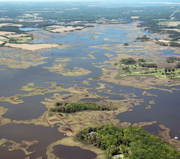
Photo, top: High amounts of nitrogen have stressed ecosystems of Mid-Atlantic coastal bays like Maryland's Newport Bay. Credit: Integration and Application Network
See all posts from the On the Bay blog
Program Announcements
News and Blogs


ON THE BAY - BLOG ARCHIVE
ON THE BAY - BLOG TOPICS
Featured Fellow
Nina Santos
Nina Santos is a Ph.D. student at the Chesapeake Biological Laboratory at the University of Maryland Center for Environmental Science. For her dissertation, she is focused on small shrimp-like crustaceans called mysids – an understudied yet important part of many estuarine and coastal food webs.
Featured Research Project
Developing a habitat model for mysids, an important link in Chesapeake Bay food webs
Mysids are important mesozooplankton prey for many species of fish in Chesapeake Bay and are an important link in transferring energy from lower to upper trophic levels. Mysids also serve as biological vectors for benthic-pelagic coupling due to their diel vertical migration and omnivorous prey-switching behavior, which makes mysids important regulators of food web architecture. Despite their central role in coastal food webs, surprisingly little is known about mysid ecology and dynamics in Chesapeake Bay.
Related Products

Chesapeake Environmentalism: Rethinking Culture to Strengthen Restoration and Resource Management
In the first issue of this monograph series, Chesapeake Perspectives, cultural anthropologist Dr. Michael Paolisso provides his perspectives on environmentalism and the Chesapeake. Building on his studies of diverse communities—from watermen to…
